Waste to Governance: Making Data Infrastructure Visible
MLA Studio, Harvard Graduate School of Design (2021)
Advised by Robert Gerard Pietrusko
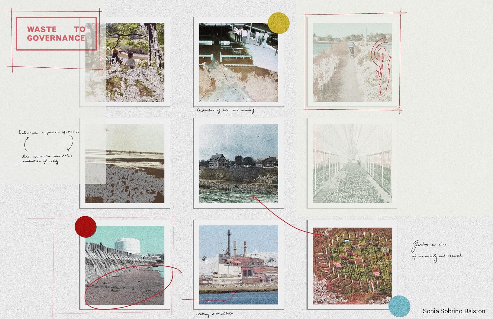
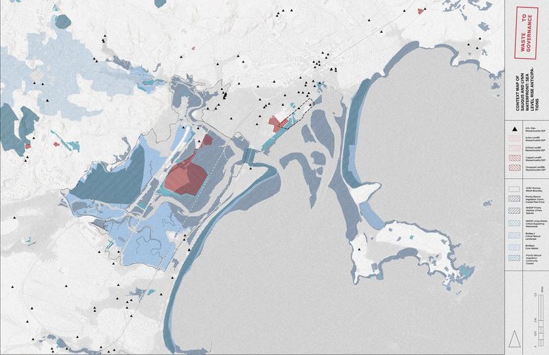
Just north of the city of Boston, two incongruous spaces are sited directly next to one another: a waste-to-energy plant and its ash landfill lies within the boundaries of an endangered salt marsh. This absurd juxtaposition is acutely visible at the site, but also particularly in the spatial data that is readily accessible in state-managed databases. As sea levels rise, the endangered saltmarsh washes away into the ocean, and toxicants leach into soil and water, the question of who captures and informs environmental data becomes increasingly politicized as these structures of knowledge shape what landscapes are to be valued and protected, and what ones are to be polluted or lost altogether. The environmental data that is available through state-run institutions, while incredibly useful, is difficult to access both intellectually and physically. This is particularly troubling as the data is used as a central tool to inform the spatial practices of design for climate change. This site, despite being at risk, might also provide us with tools to understand what ways the environment is sensed, understood, and acted upon in the age of climate change.
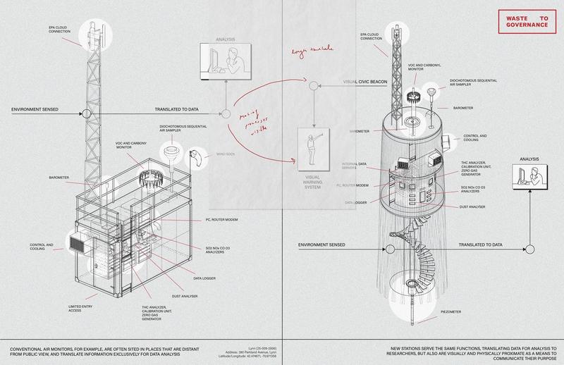
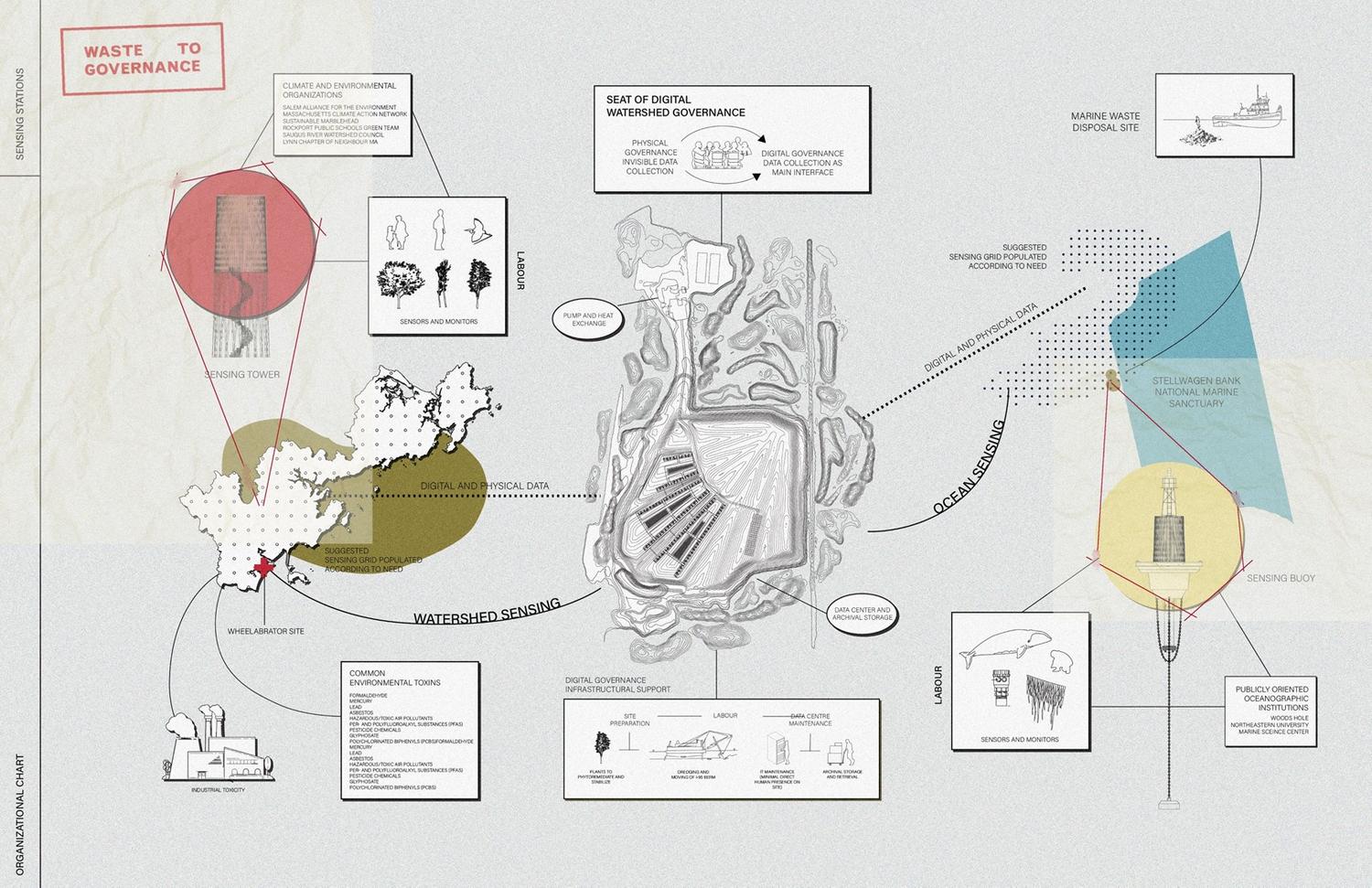
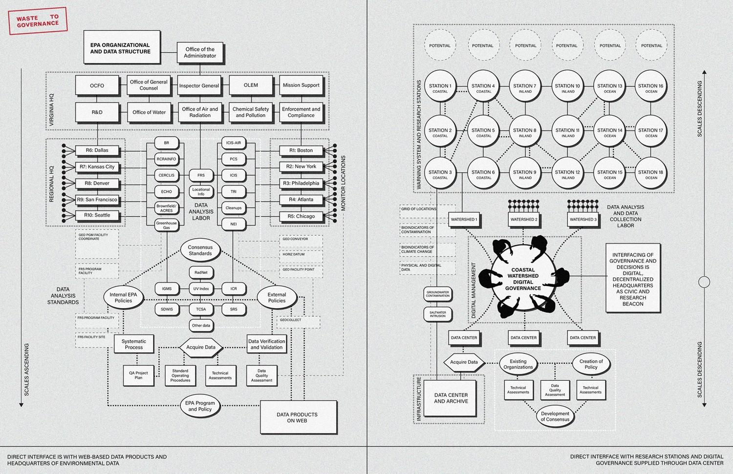
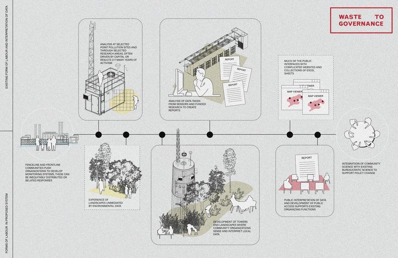
Waste to Governance imagines a new form of digital watershed governance that utilizes vacant spaces across the broader territory to create a network of public sensing stations whose data is housed in a public data center at the site of the landfill. A grid of potential sensing sites offers alternative forms of landscape sensing that supplement existing climate data, arguing that the collection of environmental data on toxicity and climate change is best understood by its own residents at the level of granularity of the neighbourhood, rather than as layers of geospatial data housed in the depths of government agencies’ websites. Using plants as indicators of pollution and environmental change in addition to more traditional sensing regimes, the project aims to harness the landscape as a form of sensing device operating at a long timescale where the public’s labour to maintain the site informs the collection of data. At the public data centre on the site of the landfill, the pumping system used to keep flooding at bay is repurposed and supported for new critical digital infrastructure; the data center becomes a tool of investment against coastal erosion in a toxic site. In short, the grid of sensing stations and the public data center view the collection and processing of data as a tool for political praxis to better understand how contaminated and vulnerable landscapes change, and offer public ownership over the knowledge and systems that govern design for climate.
MLA Studio, Harvard Graduate School of Design (2021)
Advised by Robert Gerard Pietrusko
Just north of the city of Boston, two incongruous spaces are sited directly next to one another: a waste-to-energy plant and its ash landfill lies within the boundaries of an endangered salt marsh. This absurd juxtaposition is acutely visible at the site, but also particularly in the spatial data that is readily accessible in state-managed databases. As sea levels rise, the endangered saltmarsh washes away into the ocean, and toxicants leach into soil and water, the question of who captures and informs environmental data becomes increasingly politicized as these structures of knowledge shape what landscapes are to be valued and protected, and what ones are to be polluted or lost altogether. The environmental data that is available through state-run institutions, while incredibly useful, is difficult to access both intellectually and physically. This is particularly troubling as the data is used as a central tool to inform the spatial practices of design for climate change. This site, despite being at risk, might also provide us with tools to understand what ways the environment is sensed, understood, and acted upon in the age of climate change.
Waste to Governance imagines a new form of digital watershed governance that utilizes vacant spaces across the broader territory to create a network of public sensing stations whose data is housed in a public data center at the site of the landfill. A grid of potential sensing sites offers alternative forms of landscape sensing that supplement existing climate data, arguing that the collection of environmental data on toxicity and climate change is best understood by its own residents at the level of granularity of the neighbourhood, rather than as layers of geospatial data housed in the depths of government agencies’ websites. Using plants as indicators of pollution and environmental change in addition to more traditional sensing regimes, the project aims to harness the landscape as a form of sensing device operating at a long timescale where the public’s labour to maintain the site informs the collection of data. At the public data centre on the site of the landfill, the pumping system used to keep flooding at bay is repurposed and supported for new critical digital infrastructure; the data center becomes a tool of investment against coastal erosion in a toxic site. In short, the grid of sensing stations and the public data center view the collection and processing of data as a tool for political praxis to better understand how contaminated and vulnerable landscapes change, and offer public ownership over the knowledge and systems that govern design for climate.
Territorial Strategy
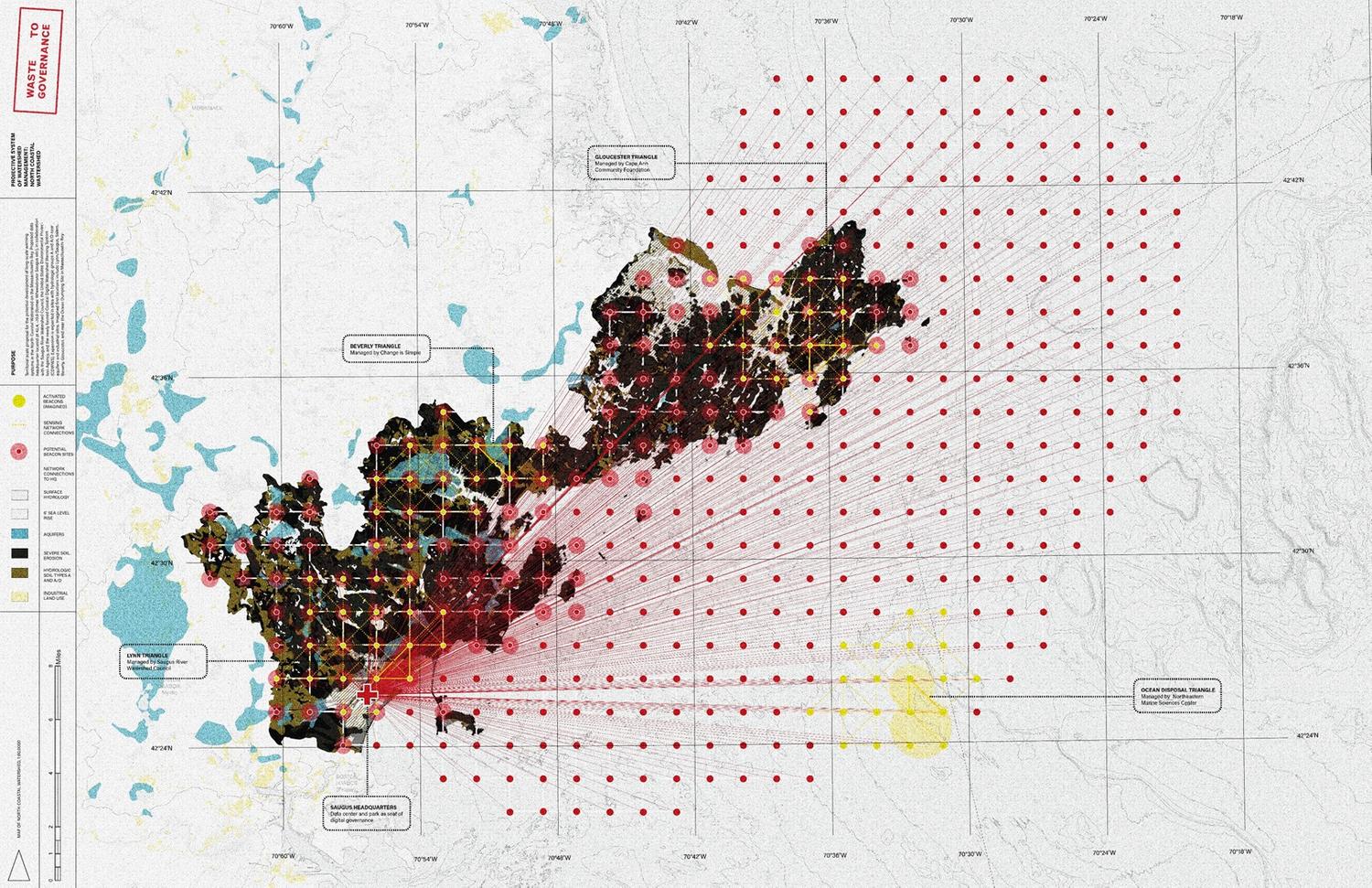

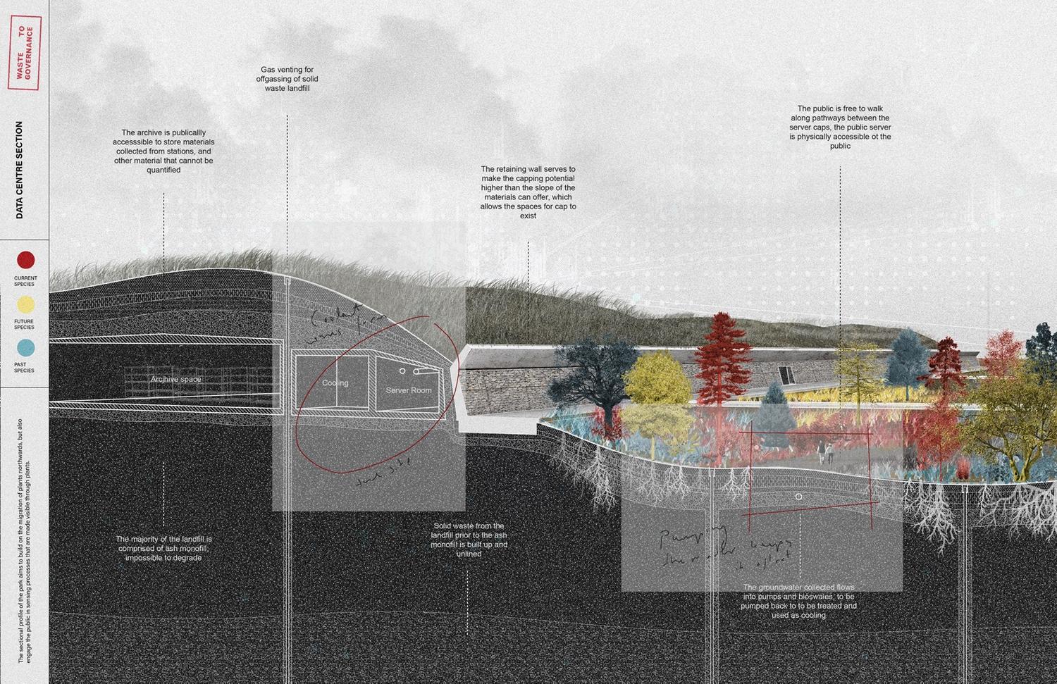
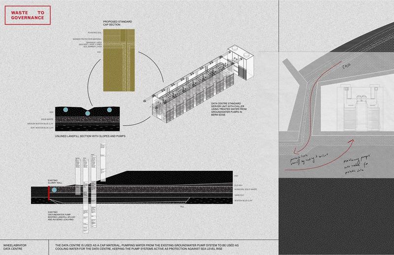
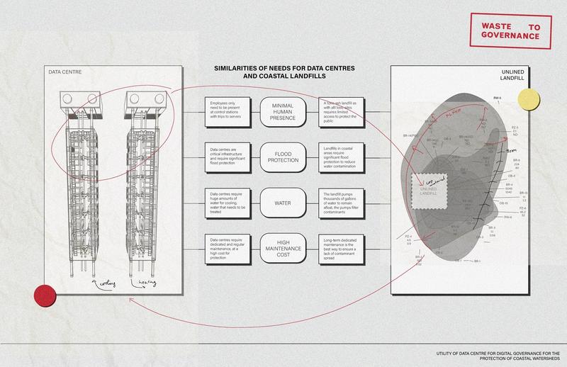
Site 1: Public data centre
The public data centre serves as the centre of governance for the watershed’s stations. By using the data centre as a cap material, the site uses existing water pumping infrastructure that is part of the waste-to-energy systems to keep the inundating marsh afloat, but also to be treated and used as cooling water for the data centre. Despite having very different infrastructural and productive purposes, data centers and landfills have similar requirements which offers a fruitful reciprocity between these two programs.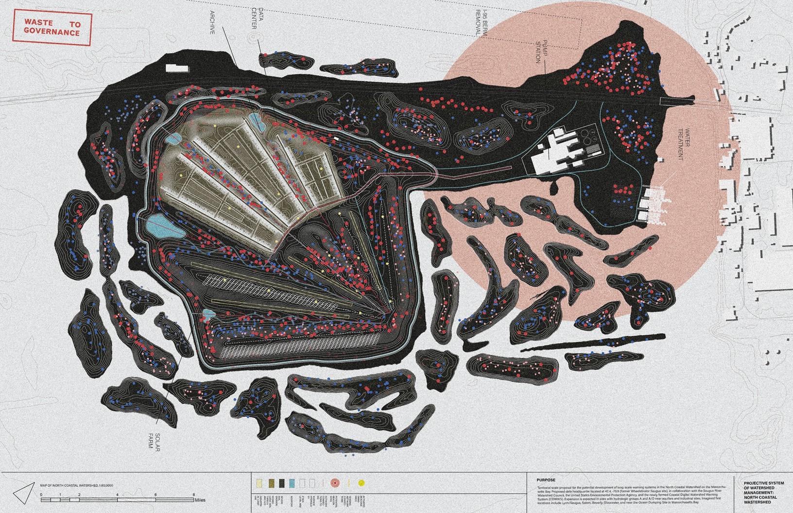
Site 2:
Lynn Triangle Waterfront
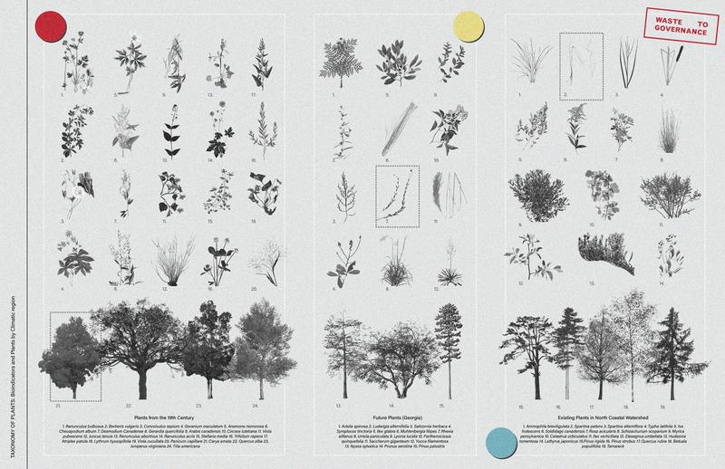
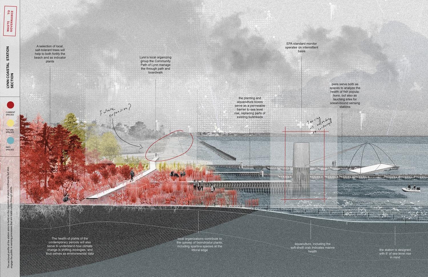
In nearby Lynn on a disused section of waterfront, a major gridded experiment of plants is introduced as a way to measure sea level rise through saltwater intrustion. Using plants from across three time periods—plants sourced from a 19th century field guide, contemporary plants in the area, and future plants expected to migrate with climate change—the park becomes an experiment where the high-tech sensors transform into a public beacon. 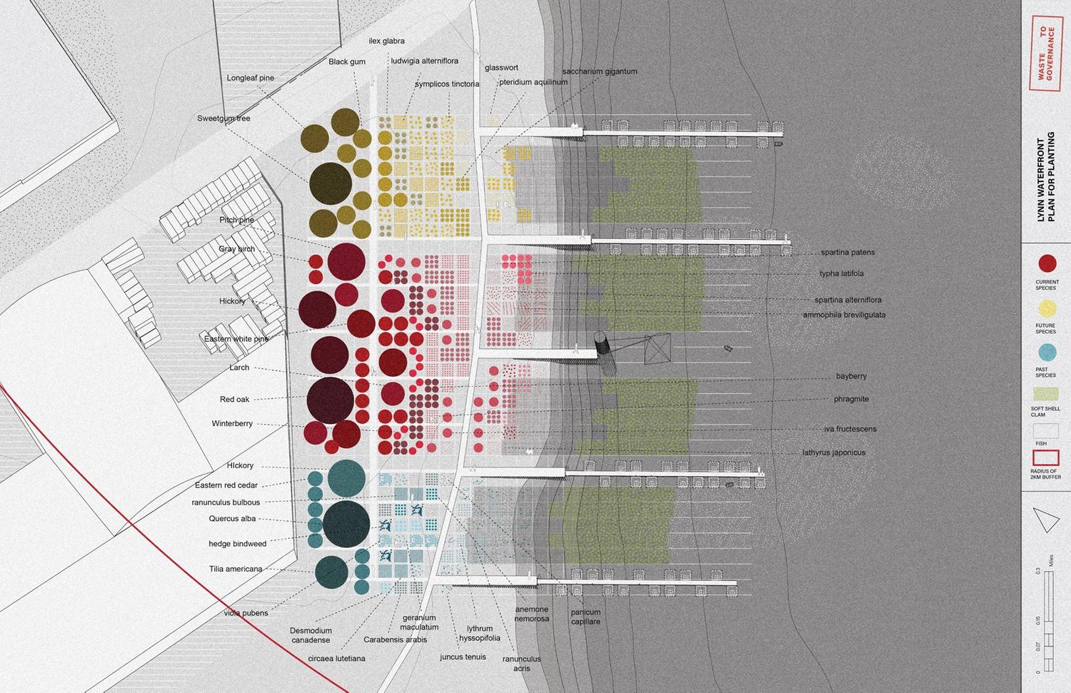

Site 3: Lynn Triangle Inland
Further inland, the same array of plants is integrated into the design of a community garden. According to the divoted site, plants and their root depth are meant to have variable sensitivity to saltwater intrusion to signal changes to the aquifer almost a kilometer from the 2020 shoreline. The public is invited to see and feel the beacon, while before they may have been hidden far afield out of public view.